Zechstein environments at Blackhall Rocks

Zechstein environments at Blackhall Rocks Adapted from :Perri et al. 2013 https://doi.org/10.2110/jsr.2013.65
Zechstein environments at Blackhall Rocks
Zechstein environments at Blackhall Rocks Adapted from: https://deeptime.voyage/apps/geoExplore/fieldtrips/PermianNE/PD6.pdf
Geological cross section of the rock between Houghton Le Spring and Seaham
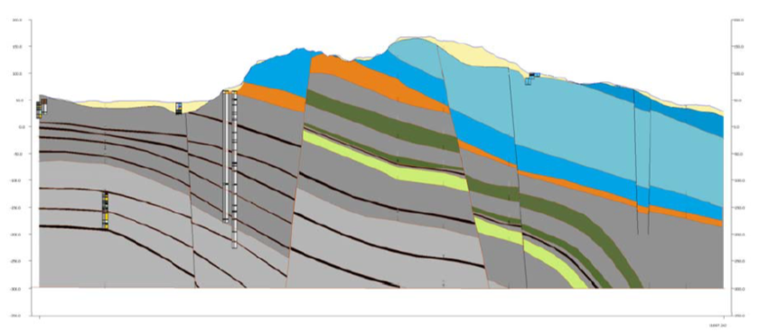
Source: https://nora.nerc.ac.uk/id/eprint/516223/1/CR07117N.pdf
Permian Zechstein cycles and sea-level change
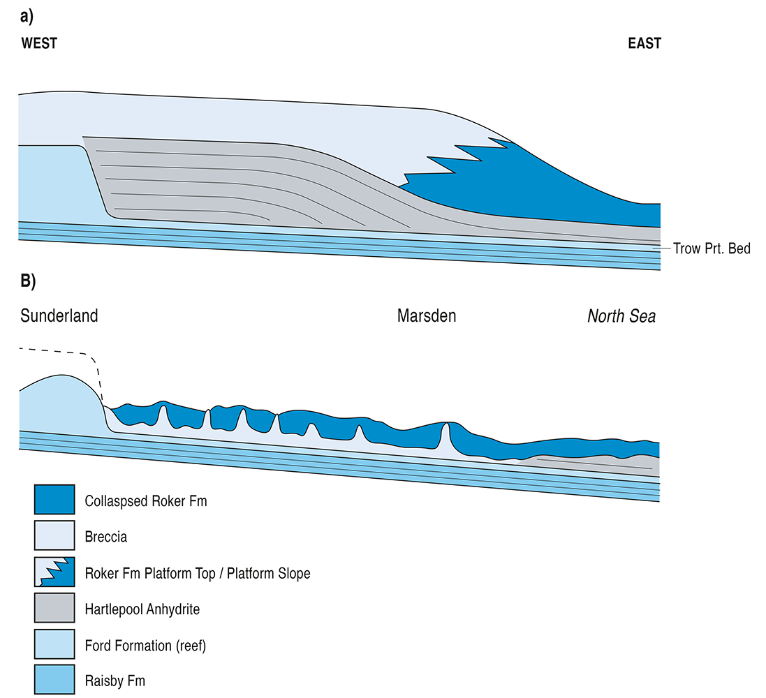
From Daniels et al. 2019: https://doi.org/10.1144/sp494-2019-140 This geological cross section from Daniels et al. (2019) demonstrates how the Permian rocks built-up layer by layer, cycle by cycle along the Durham coast. The Raisby and Ford Formations are limestones which formed in deeper water and onlap the shallow reefs at the edge of the Zechstein Sea […]
Permian rocks: (sequence)

The Permian sequence in NE England record changes in sea-level within a regional, tropical sea referred to as the Zechstein Sea The cyclical changes in sea-level fluctuations are referred to as Zechstein Cycles Z1-Z5 The black arrows in Fig 1 from Tucker (1991) show the start and end of each cycle. Along the Durham coast […]
Permian rocks: (290-248 million years ago)
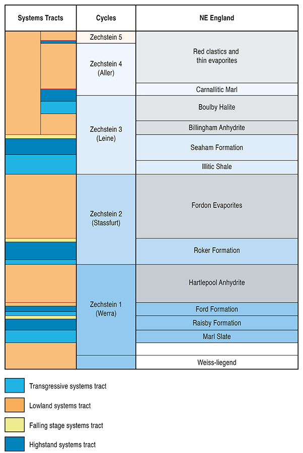
The Permian rocks in NE England record changes in sea-level within a regional, tropical sea referred to as the Zechstein Sea The cyclical changes in sea-level are referred to as Zechstein Cycles Z1-Z5 Sea Level High When sea-level is high the Zechstein sea is filled with limey muds that turn to limestone over time = […]
The Durham coast during the Permian
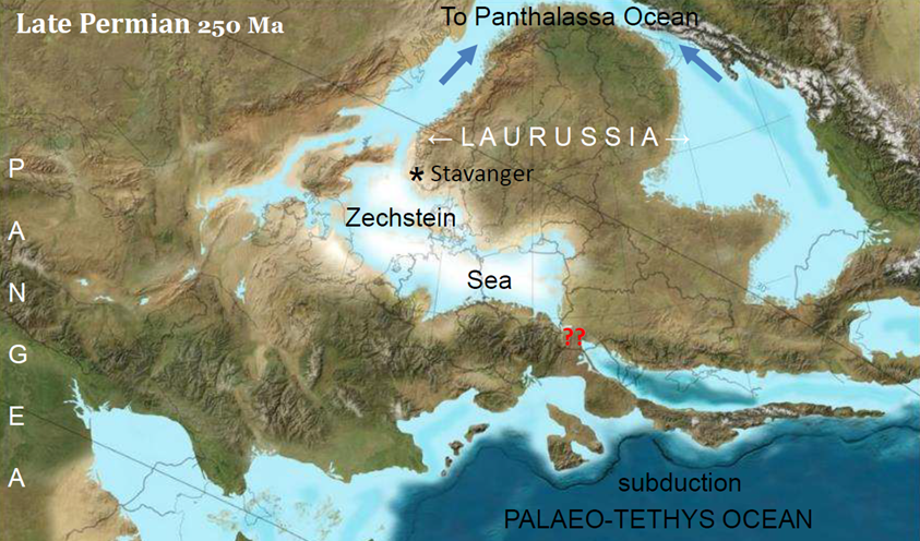
Zechstein Sea (25o million yrs ago) The Zechstein stretched east in central Europe and north towards the Panthalassa Ocean Source: BLAKELY (2014)
The Durham coast during the Permian (western edge of Zechstein Sea)
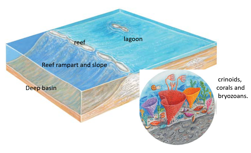
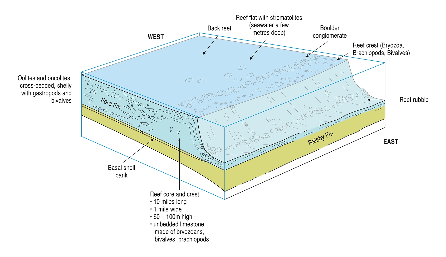
The western edge of the Zechstein Sea Shallow reefs with fringing lagoons, reef rampart and deeper water to the east Source: https://limestonelandscapes.info/wp-content/uploads/2021/11/CliffsCavesCuriousRocksA4.pdf
The Durham coast during the Permian (Zechstein Sea)
The western edge of the Zechstein Sea Shallow reefs with fringing lagoons, reef rampart and deeper water to the east Source: Tim Pettigrew
The Durham coast during the Permian (Marl Slate)
The Marl Slate (finely laminated shales) signifies rapid drowning of the Yellow Sands (aolian dunes) as the sea flooded in at the start of Zechstein Cycle 1 (Z1). Conditions in the lower water column were anoxic leading to amazing fossil preservation of offshore, nearshore and terrestrial fauna and flora. Platysomus (shallow seas) Source: Tim Pettigrew