Geological cross section of Quaternary and Permian rocks on top of the Carboniferous rocks in County Durham
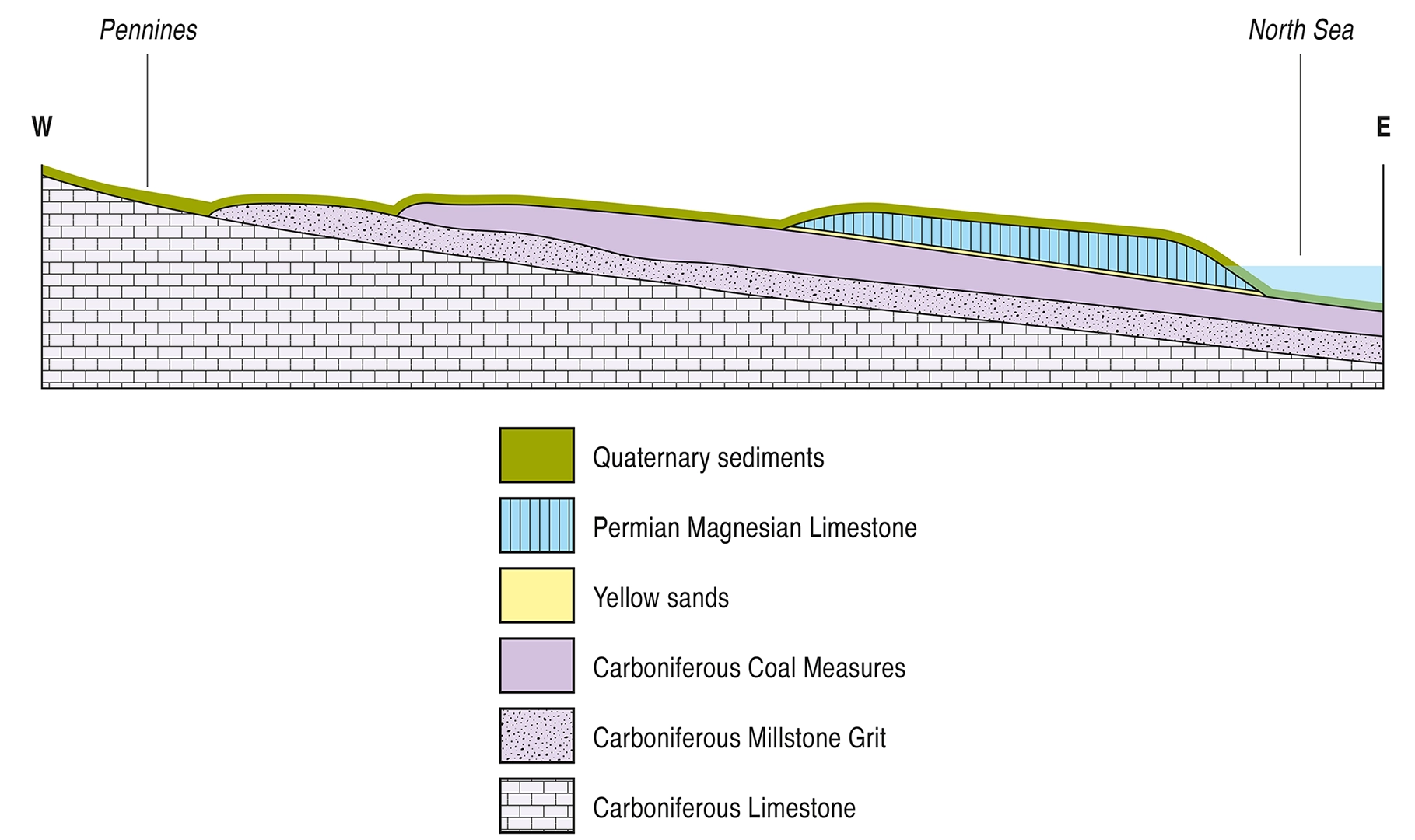
A simple geological cross section showing the younger Quaternary and Permian rocks sitting over the Carboniferous rocks in County Durham
Key geological formations in the Carboniferous and Permian rocks along the Durham coast
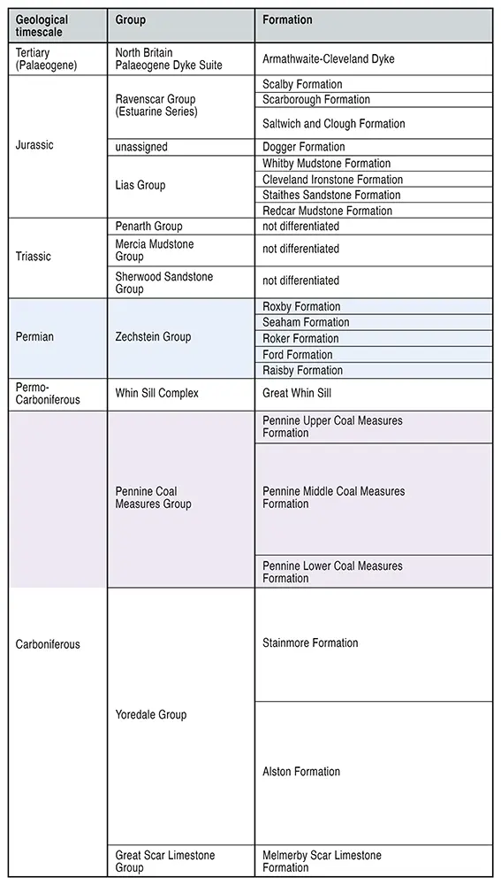
Key geological formations in the Carboniferous and Permian rocks along the Durham coast The bedrock geology of Durham and North Yorkshirehttps://historicengland.org.uk/images-books/publications/building-stones-england-durham-tyne-and-wear-tees-valley/bse-durham-tyne-and-wear-tees-valley/ https://historicengland.org.uk/images-books/publications/building-stones-england-durham-tyne-and-wear-tees-valley/bse-durham-tyne-and-wear-tees-valley/
Distribution of Rocks across the Durham landscape
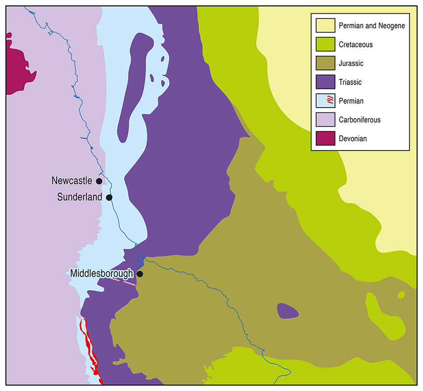
A plan view map showing the distribution of rocks across the Durham landscape • Key geological periods• The Carboniferous, Permian, Triassic , Quaternary
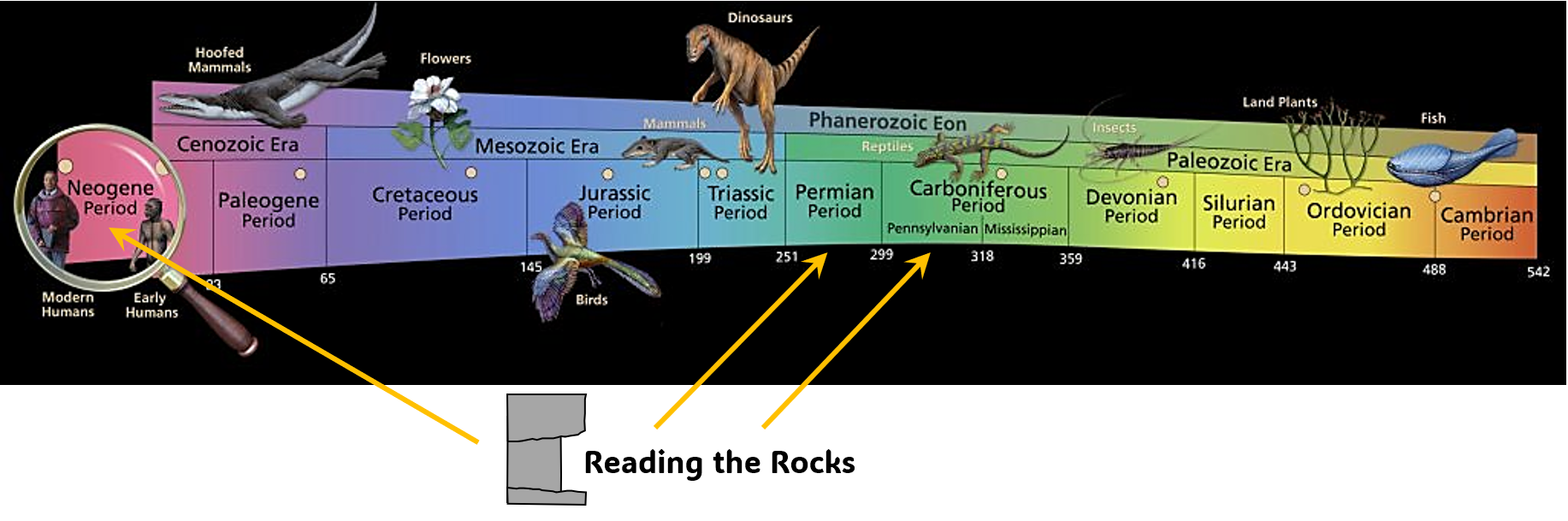
The Foundations of the Durham landscape: Key geological periods
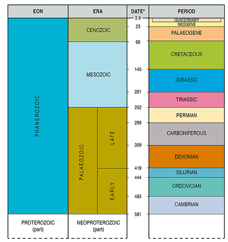
The Foundations of the Durham landscape: Key geological periods • Carboniferous (359-299 million yrs old)• Permian (299 -252 million yrs old)• Triassic (252-201 million yrs old)• Neogene/Quaternary (2.6-0 million yrs old) https://www.bgs.ac.uk/discovering-geology/fossils-and-geological-time/geological-timechart/
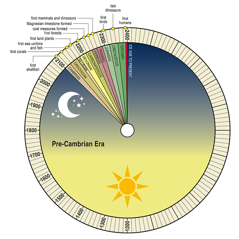
Geological timescale
https://samnoblemuseum.ou.edu/common-fossils-of-oklahoma/how-paleontologists-tell-time/geological-timescale/
Geological Time as a Single Day
The Quaternary: The Devensian Ice sheet
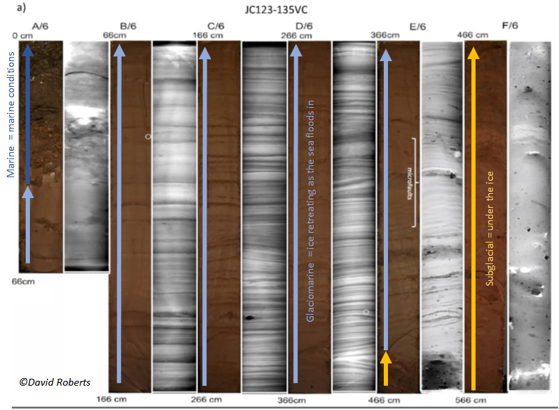
All across the seabed offshore there is a clear record of the ice disappearing and the sea flooding in between 19,000 – 16,000 yrs ago. This is shown by the transition from subglacial sediments to glaciomarine sediments Eventually fully marine conditions were re-established offshore and throughout the Holocene (the last 10,000ys) our coastline began to […]
The Quaternary: The Devensian Ice sheet (North Sea Lobe)
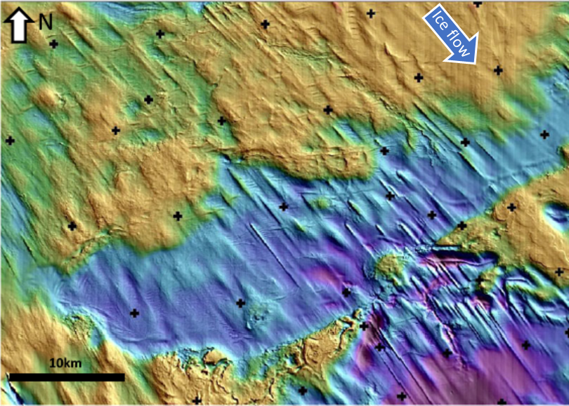
Offshore from County Durham and Northumberland the imprint of the final phase of glaciation can be seen on the seafloor. This is often referred to as the ‘North Sea Lobe’ and was fed by Scottish ice from the Firth of Forth Ice Stream. There are streamlined bedforms (drumlins and MSGL) as well as meltwater channels […]
The Quaternary: The Devensian Ice sheet (seafloor)
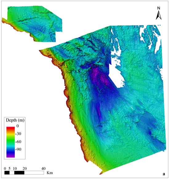
Offshore from County Durham and Northumberland the imprint of the final phase of glaciation can be seen on the seafloor. This is often referred to as the ‘North Sea Lobe’ and was fed by Scottish ice from the Firth of Forth Ice Stream. There are streamlined bedforms (drumlins and MSGL) as well as meltwater channels […]
The last glacial cycle: The Devensian – sediment record
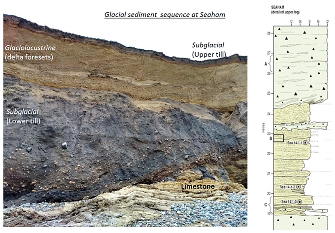
Along the Durham coast glacial sediments record multiple events as the ice passed over the coast and then retreated At Seaham Glaciofluvial sediments: record meltwater flowing away from the ice mainly during deglaciation ~ 19,000yrs BP Glaciolacustrine sediments: record the damming of meltwater and lake formation with water trapped between the ice and high ground […]